Rich Preset Coordinate System
Satisfy all your coordinate system needs with many built-in coordinate systems, and customize and export your coordinate system parameters.
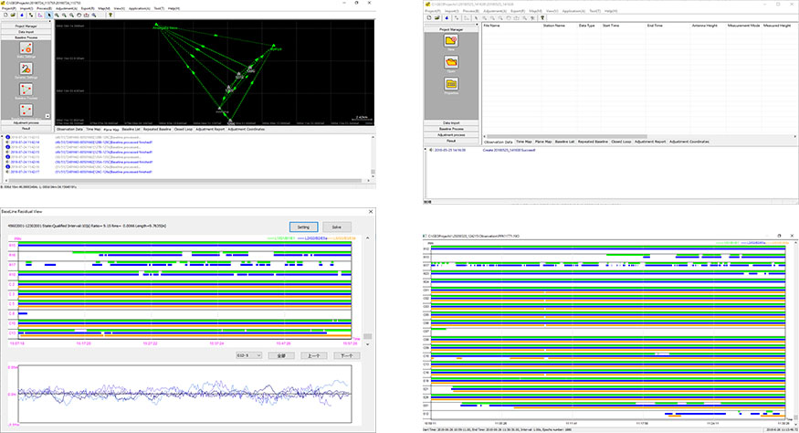
Standard Data Processing Reports
Know the accuracy and results of baseline and measurement differential solutions via the informative reports on Static data processing.
PPK Data and Static Data Supported
Quickly and accurately process static and PPK data, making your job easier.
Built-in Rinex Data Converter
Supports the import of different formats of base maps including, but not limited to AutoCAD formats (DXF, DWG), SHP and Land XML, which provides a more user-friendly experience during fieldwork.
Output Format Customizable
Customize the format of the output results, allowing you to output your measurements more quickly and efficiently.
Safely Stored Projects
The entire process, including baseline solution, network adjustment and other operations, can be operated in the project folder. All operations are automatically recorded.

 Building B, No.4 Yongjia North Road, Haidian District, Beijing, China
 overseas@unistrong.com
 +86 400-999-8088 (Press 3)


