Lightweight and Integrated Backpack Design: Easy to Carry
Easily carry it by yourself in a variety of complex environments, with a total weight of less than 14 kg.
Intelligent Battery: Reliable BMS System
Battery capacity accurate to 5%, charge and discharge safety protection. Use the CAN interface to communicate with the flight control and charger. The device offers a one-key switch power display, discharge, and heating modes.
Unique Design: Sci-fi Look
Experience extreme waist push power; flying power is leveled in the waist.
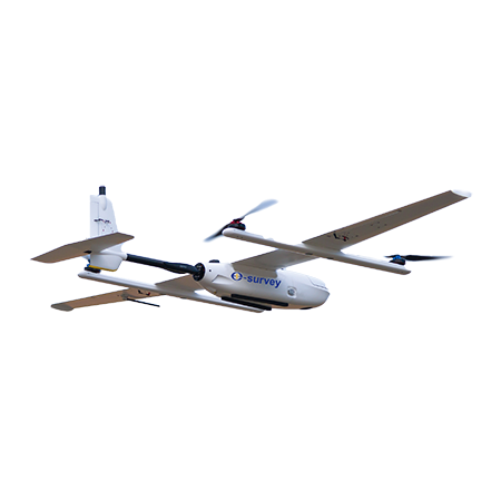
RTK/PPK: Accurate Flight and Precise Mapping
Powered with both RTK and PPK modes. RTK is mainly used for precisely and autonomously vertical land by the accuracy of centimeter-level, while PPK is used to output high-precision POS data, ensuring a reduction of more than 80% ground control points.
Dual Redundant Backup: Escort for Your Safety
Enjoy dual safety systems, in which the eDrone1 will automatically switch over to the standby system if the active one (built-in system) is not working during flight.
Automation: Simplicity of Operator
No remote controller, one button for takeoff and land. Landing accuracy within 10 cm.
|
Hardware |
Fuselage | 1300 mm |
| Height | 620 mm | |
| Wingspan | 2200 mm | |
| Maximum takeoff weight | 6.8 kg | |
| Smart battery | 18000 mAh | |
| Smart battery charger | 1200 W x 2 | |
| Radio link | 840 - 845 M | |
| Carrying case size | 1200 mm(L) x 500 mm(W) x 400 mm(H) | |
|
Software |
Flight planning software | eFlight Commander software |
|
Flight |
Flight endurance | 1 hour |
| Cruise speed | 65 km/h | |
| Wind resistance | Level 6 (10.8 - 13.8 m/s) | |
| Waterproof | Rainfall capacity ≤ 10 mm / 24h | |
| Take-off and landing | VTOL | |
| Maximum flight ceiling | 6000 m | |
| Maximum takeoff altitude | 4500 m | |
| Positioning accuracy | Vertical: 1.5 cm + 1 ppm Horizontal: 1 cm + 1 ppm | |
|
Payload |
Mission payload | 1 kg |
| Number of CCD | 1 | |
| Sensor size | 35.7 mm x 23.8 mm (35 mm full frame) | |
| Effective pixels | 61MP | |
| Storage capacity | Photo: 256GB x 1 (TF card) POS: 16GB x 1 (TF card) | |
| Working temperature | -20°C ~ 45°C | |
| Weight | About 290 g (only camera) |

 No.8 Kechuang 12 Street, Economy & Technology Zone, Beijing, China.
 overseas@unistrong.com
 +86 400-999-8088 (Press 3)


