Fast Scanning Speed
Its scanning speed can be up to 655,000 points per second.
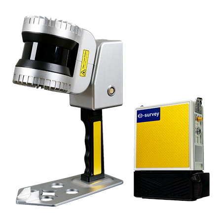
Portable and Efficient
Compact and portable. Capture 3D point cloud data efficiently while moving around.
High Data Accuracy
More high-precision 3D point cloud data can be obtained, supported by the new high-precision SLAM algorithm.
Impressive Memory Storage
It is equipped with a 1T solid-state disk.
Real-Time Data Visualization
Visualize data in real-time with a smartphone or tablet.
Multi-platform Supported
It can be expandable to multiple platforms, including a backpack, vehicle, intelligent robot, etc.
|
Specifications | |
| Range | 120 m |
| LiDAR channels | 32 |
| Points per second | 655,000 |
| Laser product classification | Level 1 |
| Laser wave length | 865 nm |
| FOV | 360° x 270° |
| Scanning accuracy | 3-5 cm |
| Data format | DAT, PCD |
| Dimension | Handheld: 295 mm x 197 mm x 99.7 mm (with handle) Host: 128 mm x 185 mm x 52 mm |
| Weight | Handheld: 1.6 kg (with handle) Host: 1.0 kg (without battery) |
| Housing | Aircraft-grade aluminium (high protection and high interference resistance) |
| Power Supply | 12 ~ 24 V dc/25 W |
| Working time | 3 hours (one battery) |
| Storage | 1T (expandable) |
| Working Environment | Indoor and Outdoor |
| Working Temperature | -20℃ ~ 60℃ |
| Protection Level | IP54 |

 No.8 Kechuang 12 Street, Economy & Technology Zone, Beijing, China.
 overseas@unistrong.com
 +86 400-999-8088 (Press 3)


