AR Visual Positioning: More Efficient Stakeout
There is no need to move the pole back and forth and rely on work experience during a stakeout. Follow the visual guide to precisely find the target stakeout point. Suitable for a non-experienced user and provide up to 50% more efficiency.
Max 60° Tilt Survey: A Different Way of Working
- Quickly measure accurate points while standing or walking without leveling the pole.
- Concentrate on where the pole tip needs to go, which is especially useful during a stakeout.
- Easily start a survey in environments that are hard to reach, such as building corners and slopes.
- No longer worry about the movement of the pole when measuring, provided that the pole tip is stationary.
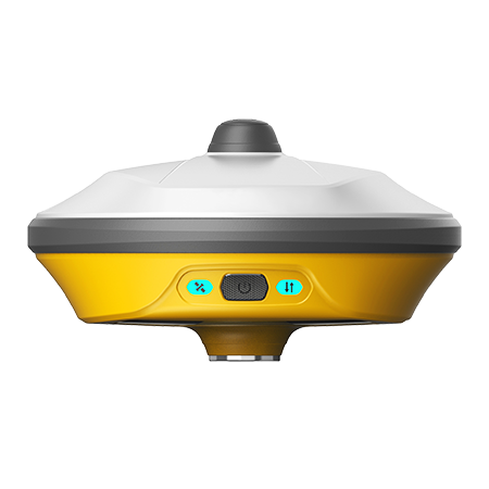
Rugged Design: IP68 Certified
No need to worry about any tough environments, for rated IP68 will be both dust-tight and protected against the effects of continuous immersion in water.
Multi-constellation and Multi-frequency
With 1408 channels of GNSS tracking, it provides stable and reliable accuracy. All GNSS signals come with the standard including GPS, BDS, GLONASS, GALILEO, and QZSS.
Light Weight & Compact Design
The compact design of the eRTK10 makes it a small size and lightweight GNSS receiver, it is easy to carry around by users without getting tired.
Web UI
It allows users to view position status, set up working mode, download data, and update firmware from the Web user interface with any smartphone, tablet, or PC.
|
GNSS Performance |
eRTK10 | |
|
Satellites tracking |
GPS |
L1CA, L2P(Y), L2C, L5 |
|
BDS |
B1I, B2I, B3I, B1C, B2a, B2b | |
|
GLONASS |
L1, L2 | |
|
GALILEO |
E1, E5a, E5b, E6 | |
|
QZSS |
L1, L2, L5, L6 | |
|
IRNSS |
L5 | |
|
SBAS |
WAAS, GAGAN, MSAS, EGNOS, SDCM | |
|
L-Band |
B2b PPP (Only for the Asian-Pacific region), HAS1 | |
|
Channels |
1408 | |
|
Cold start |
< 30 seconds | |
|
Warm start |
< 20 seconds | |
|
Hot start |
< 5 seconds | |
|
RTK signal initialization |
< 5 seconds | |
|
Initialization reliability |
> 99.9% | |
|
Update rate |
20 Hz | |
|
High precision static |
- H: 2.5 mm + 0.1 ppm (RMS) - V: 3.5 mm + 0.4 ppm (RMS) | |
|
Static and Fast Static |
- H: 3 mm + 0.5 ppm (RMS) - V: 5 mm + 0.5 ppm (RMS) | |
|
RTK |
- H: 5 mm + 0.5 ppm (RMS) - V: 10 mm+0.5 ppm (RMS) | |
|
Standard point positioning |
- H: 1.5 m (RMS) - V: 2.5 m (RMS) | |
|
Code differential |
- H: 0.4 m (RMS) - V: 0.8 m (RMS) | |
|
SBAS |
- H: 0.3 m (RMS) - V: 0.6 m (RMS) | |
|
Correction data |
RTCM V3.X, RTCM2, CMR | |
|
Data output |
GGA, ZDA, GSA, GSV, GST, VTG, RMC, GLL, Binary | |
|
Power Supply | ||
|
Battery |
Rechargeable Built-in Lithium-ion battery x 1 3.6V ~ 13600 mAh Support 20W fast charging | |
|
Voltage |
12V Type-C | |
|
System | ||
|
Operation system |
Linux | |
|
Internal memory |
8 GB | |
|
Bluetooth |
BT 5.0 + EDR, BLE | |
|
Wi-Fi |
802.11 b/g/n/ac | |
|
TNC |
Connect internal radio with antenna | |
|
Type-C port |
Charge and data transmission | |
|
Web UI |
View status, update firmware, set up working mode, download data, etc. | |
|
Intelligent voice |
Broadcast working mode and status | |
|
MEMS |
Fast initialization, dynamic tilt survey up to 60° | |
|
Physical | ||
|
Dimension |
Φ152 mm x H88 mm | |
|
Weight |
891 g | |
|
Operating temperature |
-30℃ ~ +60℃ | |
|
Storage temperature |
-40℃ ~ +80℃ | |
|
Water/dustproof |
IP68 | |
|
Shock |
- Withstand topple over from a 2 m survey pole onto hard surfaces - Survive a 1.2 m free drop | |
|
Vibration |
Vibration resistant | |
|
Humidity |
Up to 100% | |
|
Indicators |
Satellites, datalink, battery | |
|
Button |
The power button, short press to voice broadcast working mode and status | |
|
Internal Radio | ||
|
Type |
RX | |
|
Frequency range |
410 ~ 470 MHz | |
|
Channel spacing |
6.25 KHz / 12.5 KHz / 25 KHz | |
|
Protocol |
Satel, PCC, TrimTalk, TrimMark III, TRANSEOT(PCC-GMSK), South, HiTarget, GEOTALK, GEOMK3, HZSZ | |
|
Visual Configuration | ||
|
Pixel |
2 MP | |
|
Frame |
25 Hz | |
|
FOV |
88° | |
|
Photo sensibility |
Micro-light level high sensitivity | |
|
Stakeout accuracy |
3cm | |

 No.8 Kechuang 12 Street, Economy & Technology Zone, Beijing, China.
 overseas@unistrong.com
 +86 400-999-8088 (Press 3)


