 Home / News & Events / Innovation leads development, UniStrong wins three awards in the 2022 Satellite Navigation and Positioning Innovation Application
 Posted by UniStrong
 2022-9-6
 5905
5905
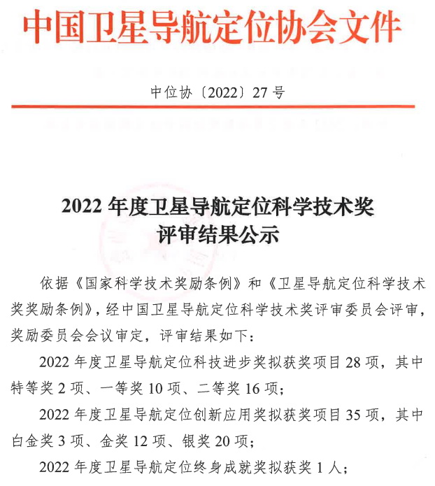
Recently, GNSS & LBS Association of China (GLAC) announced the winners of the 2022 Satellite Navigation and Positioning Science and Technology Progress Award, the Satellite Navigation and Positioning Innovation Application Award, and the Satellite Navigation and Positioning Lifetime Achievement Award. Beijing UniStrong Science & Technology Co., Ltd. ("UniStrong") and its subsidiaries won the 2022 Satellite Navigation and Positioning Innovation Application Awards -Platinum, Gold and Silver respectively.

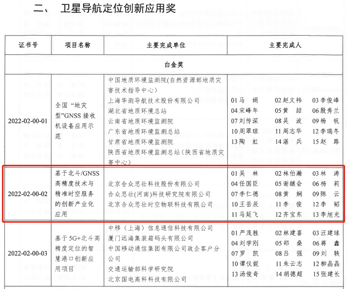
Innovative industrial application based on BDS/GNSS high-precision technology and precise spatiotemporal services
UniStrong "Innovative Industrialization Application Based on BDS/GNSS High-precision Technology and Precise Spatiotemporal Service" Project won the 2022 Satellite Navigation and Positioning Application Platinum Award.

With the thriving development of BDS application industry generated by the opening of the BDS-3 global satellite navigation system, UniStrong independently developed the multi-frequency multi-system high-precision baseband processing chip "Lyra II" and the multi-frequency multi-system four-channel broadband radio frequency chip "Aquila". UniStrong has continuously improved technology R&D and product upgrades, launched a new generation of high-precision positioning boards/modules and a series of terminal products, and actively promoted the application of BDS high-precision products in surveying and mapping, precision agriculture, deformation monitoring and other industries.
As of 2021, project-related products have been sold in more than 100 countries and regions, with a total output value of more than 4.28 billion CNY. At the same time, during the implementation of the project, UniStrong has applied for more than 150 domestic and foreign patents and more than 350 soft works.
GNSS digital construction application for civil aviation airport construction
Beijing UniTop Information Technology Co., Ltd. ("UniTop"), a subsidiary of UniStrong, won the 2022 Satellite Navigation and Positioning Innovation Application Gold Award for its "GNSS Digital Construction Application for Civil Aviation Airport Construction" project.

As the first project in the domestic airport field to use digital construction technology throughout its life cycle, the digital construction of Ezhou Huahu Airport relies on BDS high-precision positioning and navigation, 5G, multi-sensor data fusion and other technologies to realize the management of more than 40,000 people, nearly 1,000 construction machinery, and over 20,000 vehicles through machinery guidance, automatic control, unmanned driving, precise operation and rapid construction prototyping, remote real-time progress and quality supervision and other services, and achieve the first overall solution running through the whole process, multi-system and multi-platform data flow and sharing of design, construction, supervision, metering and payment, etc.
The project transforms complex engineering information into measurable numbers and data, supplemented by BIM technology and mechanical control technology to realize the full life cycle management of engineering construction of people, materials, vehicles and construction machinery, effectively promoting the digital and smart construction of the airport.
Civil aviation airport apron operation control system based on BDS high-precision fusion positioning
The project of "Civil Aviation Airport Apron Operation Control System Based on BDS High-precision Fusion Positioning" project of Beijing Topsci Science & Technology Co., Ltd., a subsidiary of UniStrong, won the 2022 Satellite Navigation and Positioning Innovation Application Silver Award.

The civil aviation airport apron operation control system based on BDS high-precision fusion positioning is able to provide dynamic centimeter-level positioning accuracy through BDS + 5G augmented high-precision/safety vehicle terminal and the integration of various kinds of sensors like IMU, UWB, VSLAM, etc. For dozens of operation vehicles running on the airport apron, it realizes the "accurate vehicle " that integrates the 3D model of the vehicle and the satellite positioning antenna, completely making the "point positioning" a history.
The in-depth integration of BDS high-precision positioning core technology and multi-sensor technology, combined with the popular application of 5G cloud computing and AI technology, constantly break through the function limitations of traditional satellite navigation equipment with capability to resist various harsh environmental factors and to meet the continuous high-precision positioning requirements in complex environments. The system accurately presents various flight area ground markings and flight area signs, etc., and has the ability to integrate various 2D/3D high-precision images and vector data, real-time and historical video data, field surveillance radar and multi-point positioning data in a single system. Real-time and historical data of various target trajectories are realized under the airport panoramic 3D + video fusion holographic system to achieve real-time operation monitoring, prediction, and fault/accident playback analysis with "lane-level" precision, comprehensively improving the flight guarantee efficiency of Hangzhou Xiaoshan International Airport.
Currently, the system has been successfully applied in Chengdu Shuangliu International Airport, Sichuan Airlines, Chengdu Tianfu International Airport, Kashgar Airport, Xiamen New Airport and Fuzhou Changle International Airport, and has been recognized and highly rated by users.