 Posted by UniStrong
 2022-5-19
 6278
6278
On May 18, GNSS and LBS Association of China (GLAC) released the "2022 White Paper on the Development of China's Satellite Navigation and Location Services Industry" (referred to as the "White Paper"). The white paper shows that in 2021, the overall output value of China satellite navigation and location services industry with BDS applications as the core will reach 469 billion CNY, an increase of 16.29% over 2020, and continue to maintain a rapid development momentum. Among them, the market of BDS high-precision related products reached 15.19 billion CNY, and the application of BDS high-precision positioning technology in various fields also indicated a trend of ubiquity and scale.
In recent years, GNSS is continuously empowering the digital development of thousands of industries, greatly promoting the development of the satellite navigation and LBS industry in China. The development of the industry is inseparable from the empowerment of a large number of GNSS application companies that have truly mastered core technologies. Beijing UniStrong Science & Technology Co., Ltd. ("UniStrong") is one of the leading enterprises in the satellite navigation service industry with achievements and experience in technological innovation and application.
UniStrong was established in 1994 with the corporate vision of "Being a Leading Provider of High-Precision Professional Products, Solutions, and Services in the Global Geospatial Marketplace". As a company based in China for more than 20 years, UniStrong has a competitive edge covering the whole industry chain from chips, boards, high-precision core technology, terminal equipment, solutions to service platforms, forming a relatively comprehensive intellectual property system.
In recent years, UniStrong high-precision satellite navigation products and solutions have been widely used in surveying and mapping, smart agriculture, digital construction, deformation monitoring and many other industries, generating obvious economic and social benefits.
Climbing Mount Everest to facilitate the scientific research on the Qinghai-Tibet Plateau
Surveying and mapping has always been the earliest and most widely used scenario for high-precision technology applications. Based on the continuous accumulation of measurement technology, UniStrong has continuously innovated a full range of terminals and software products for surveying and mapping, ranging from core component products to RTK, optical measurement, 3D laser scanning, mobile GIS, and GNSS high-precision handhelds.
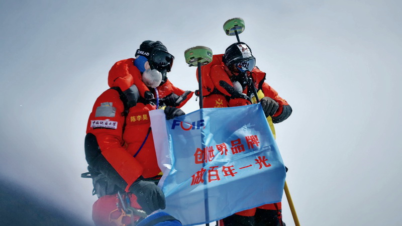
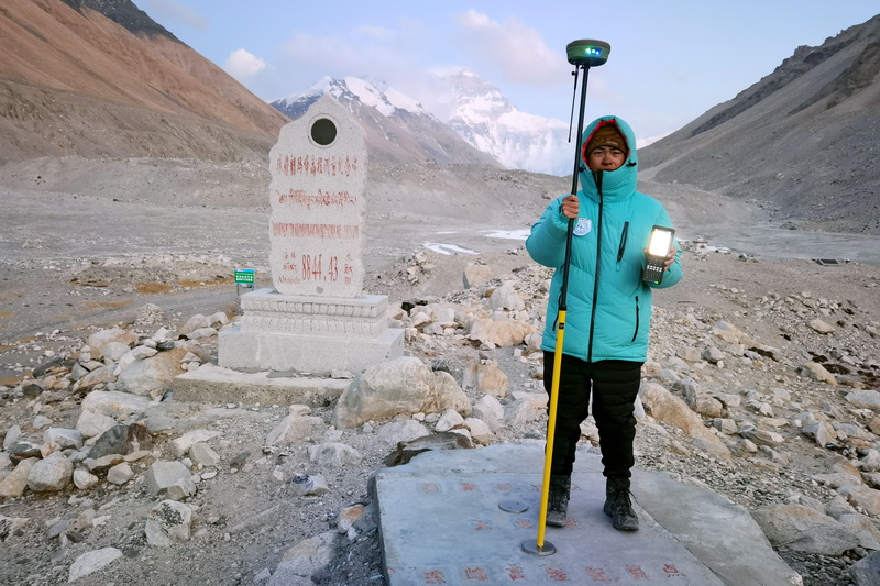
On the morning of April 30, 2022, Professor Chen Gang, who is from China University of Geosciences (Wuhan) School of Oceanography, along with UniStrong products, climbed to the top of the world - Mount Everest with an altitude of 8848.86 meters, and withstood the severe test of high altitude, low temperature and low pressure, successfully completing the scientific expedition.
Facilitating the development of precision agriculture with continuous in-depth R&D
Application is the lifeline of BDS development, and agriculture is one of the key areas of BDS application.
As an early enterprise that applied high-precision satellite navigation technology to the agricultural field, UniStrong has always been at the forefront on the road of promoting the modernization of agriculture. From HuiNong agricultural machinery auto-steering system to the intelligent agricultural machinery monitoring information platform, UniStrong has formed a "terminal" + "cloud" precision agriculture solution with continuous innovation, better serving all aspects of agricultural production.
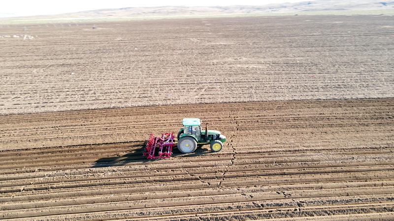

HuiNong BDS agricultural auto-steering system has the characteristics of high integration and convenient installation. It supports various operation modes such as straight line, circle, curve, and diagonal line with an operation accuracy reaching 2.5 cm. It is suitable for various types of agricultural machinery and is widely used in harrowing, plowing, sowing, film laying, saplings, ditching, spraying and harvesting, supporting the whole process of "farming, planting, management and harvesting". At the same time, through the HuiNong smart agricultural machinery monitoring information platform, users can carry out scientific management of agricultural machinery such as positioning monitoring, status monitoring, trajectory tracking, operation area statistics, command and dispatch, route planning, etc., effectively improving the utilization rate of agricultural machinery resources.
Integrating innovation to lead the new trend of digital construction
With the continuous integration of GNSS high-precision technology and new technologies such as artificial intelligence, big data, cloud computing, and 5G communications, high-precision positioning technology has been extended to various emerging application fields, digital construction application is one of them.
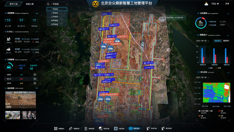
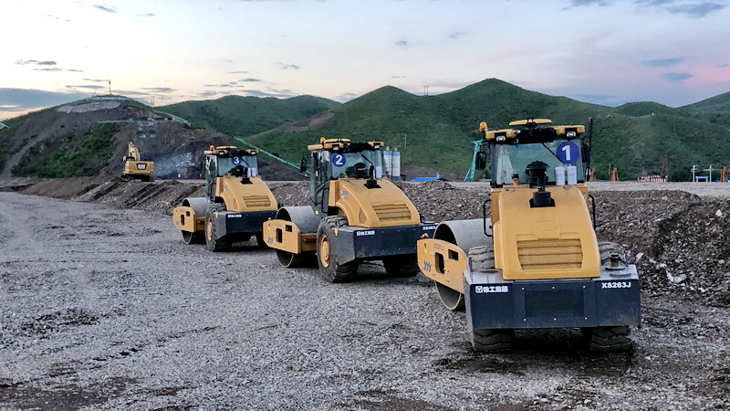
During the construction process of Ezhou Huahu Airport, the first full-process digital construction airport in China, the digital construction system independently developed by UniStrong, combined with "GNSS + 5G", enables the industrial Internet of Things, edge computing, cloud intelligence and other information means. The system achieves the comprehensive application of high-precision positioning technology from foundation treatment to layered filling and automatic control of pavement. While effectively improving construction efficiency, reducing labor and material costs, it also improves operation accuracy and control of the overall quality of the process. The GNSS digital construction management platform system has realized the full life cycle management of more than 40,000 people, nearly 1,000 construction machinery, and more than 20,000 vehicles, effectively promoting the digital information and smart construction.
In addition, UniStrong digital construction solutions have also been widely used in smart mines, river management, highways, railways and municipal construction.
Break-through in deformation monitoring
The application of satellite navigation and positioning technology in the field of deformation monitoring mainly uses high-precision positioning technology to carry out millimeter-level all-weather continuous automatic monitoring of bridges, dams, mines and large buildings, including displacement, deformation, settlement changes, etc. The system alarm and early warning mechanism can effectively reduce or prevent the occurrence of safety accidents, and has been widely used in water conservancy, mining, infrastructure and other fields.
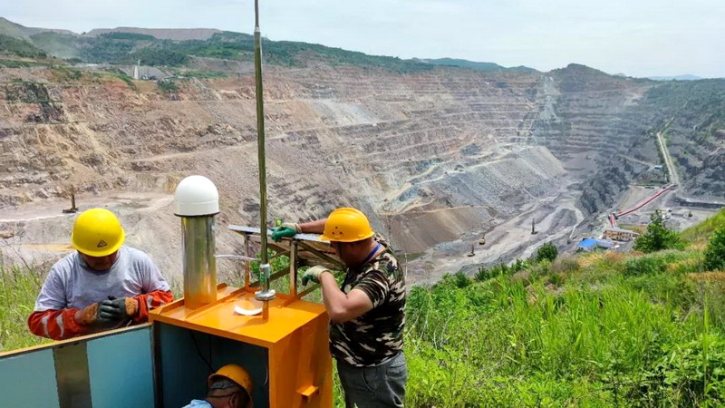
In 2021, in the safety monitoring project of a large-scale open-pit mine in Northeast China, the automated monitoring system designed by UniStrong for the complex and dangerous on-site environment in the mining area greatly improved the slope disaster early warning ability and work efficiency, and also provided intuitive and effective information support for the management of the mine, guaranteeing the security of the open-pit mine and facilitating the adjustment and management of the planning of the mine in the later stage.

In addition, the dam safety automatic deformation monitoring system designed by UniStrong for a large-scale water conservancy project in Guangxi provides long-term technical support for the automatic safety monitoring of the water conservancy project.
Atlas
In addition to industry-oriented high-precision applications, UniStrong also independently built the satellite-based wide-area differential service system "Atlas". The system was officially put into operation in 2015 and currently has more than 150,000 users worldwide.
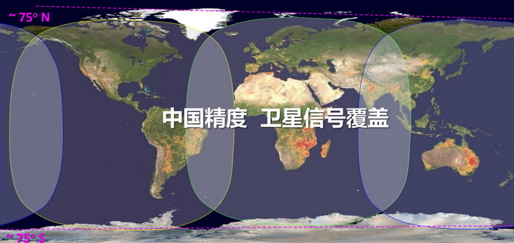
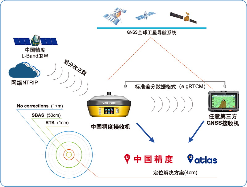
"Atlas" is an innovative, industry-leading GNSS-based global L-band correction service released by UniStrong in June of 2015. It enables the GNSS users to get enhanced high- precision data from anywhere in the world without setting up a base station and enjoy the service of sub-meter, decimeter and centimeter-level accuracy positioning services. "Atlas" has been widely used in many fields such as precision agriculture, marine and machine control.