 Posted by UniStrong
 2021-5-26
 6194
6194
On May 26, the 12th China Satellite Navigation Conference, with the theme of "Spatial-Temporal Data Empowers Bright Future", held a grand opening at the Nanchang Greenland International Expo Center in Jiangxi province, China. On the same day, Beijing UniStrong Science & Technology Co., Ltd. ("UniStrong") released a series of new popular BDS high-precision products, including 6 new products that consist of BDS high-precision handhelds, RTKs, monitoring receivers, and airborne receivers featured with the core advantages such as lighter weight, smaller size, and higher cost-effectiveness that have attracted the attention of many audiences.

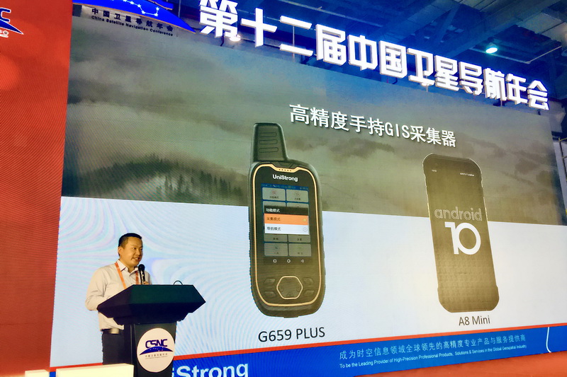
The two popular BDS high-precision handhelds released at this conference are G659 Plus and A8 Mini that can receive multi-constellation signals of the 5 satellite navigation systems - BDS/GPS/GLONASS/Galileo/QZSS, and support BDS-3, differential solution, with up to centimeter-level positioning accuracy, which is perfect for high-precision handheld GIS collection. While retaining the core functions, the two upgraded products also reduced the overall power consumption. Both are designed with an open operating system, which can expand to more industry applications.

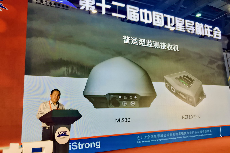
Two popular monitoring receivers, Net10 Plus and Mis30, were also released at this annual meeting with the concept of small size and lightweight design. Both support multi-constellation, multi-frequency, and self-organized network front-end solution with the functions of achieving data automatic transmission, management and calculation, health monitoring, remote upgrade of deformation, displacement and settlement of dams, foundation pits, bridges, buildings, etc. The positioning accuracy can reach millimeter level.

Multi-constellation fusion positioning has become a technical trend in the development of high-precision RTK surveying. As a feature-filled RTK receiver, UniStrong G950III was also released at this annual meeting. G950III not only supports multi-constellation, multi-frequency, and multi-compatible radio, it is also equipped with eSIM+ physical card and IMU inertial navigation. The host can remain on continuous standby for more than 12 hours, providing users with more durable operation guarantee.

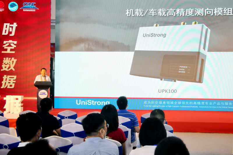
In addition, UniStrong also released the UPK100 airborne GNSS receiver for drone surveying and mapping. The product has a built-in V28 board, supporting dual-antenna heading measurement, real-time RTK solution and PPK post-processing solution. In response to the diversified functional requirements of users in the field of drone aerial surveys, it also integrates BeiDou high-precision positioning, synchronous recording of camera shutter exposure, post-processing calculations, dual storage modes and other functions to ensure higher data processing accuracy and more stable performance. With the help of the aerial survey GNSS receiver, the number of ground image control points in the aerial survey operation of the UAV can be reduced, and the efficiency of the aerial survey operation of the UAV can be improved.

Liu Hongzhi, director of high-precision products of UniStrong, said at the press conference, "We have pooled our best resources to where it is most needed. Among the new products released this time, the core indicators such as multi-constellation, multi-frequency and high-precision positioning remain outstanding, while the cost performance is even better at an affordable price to ordinary industry users. We have brought tangible high-performance products and services to industry users with our series of popular BDS high-precision products."